
Making Sense of Your Land Survey Report
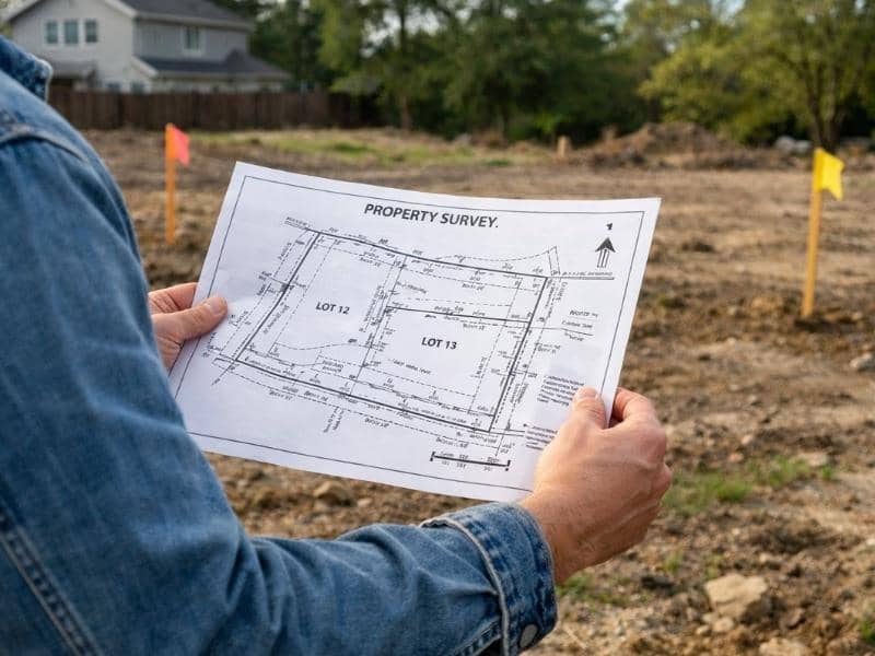
A land survey report is a map of your property filled with lines, symbols, numbers, and notes. To read it, start with the title block to confirm the basics, then study the boundary lines and their measurements, check the legend to decode symbols, and review the notes for important details like easements or flood zones.
You finally get your land survey back, open it up, and stare at a page full of strange marks, abbreviations, and numbers. It can feel like reading a foreign language. The good news is that once you know what each part means, the whole report starts to make sense. Below is a friendly walkthrough of the pieces you will find on almost every survey.
Start With the Title Block
The title block is usually in a corner of the page. Think of it as the report’s name tag. It tells you who made the survey and what it covers.
Look here first to confirm the basics:
- The property address or legal description
- The owner’s name
- The surveyor’s name, license number, and stamp
- The date the survey was done
- The scale, such as “1 inch = 30 feet”
The scale matters because it tells you how distance on paper compares to real distance on the ground. If the scale says one inch equals thirty feet, then a line two inches long stands for sixty feet of actual land.
Understand the Boundary Lines
The bold lines around the edge of the drawing show your property lines. These are the most important lines on the page because they mark where your land begins and ends.
Along each line you will see two kinds of numbers. One is the distance, written in feet, which tells you how long that side of the property is. The other is the direction, often shown as something like “N 45° E.” This is called a bearing, and it describes the angle of the line using compass directions. Together, the distance and bearing explain the exact path of each property line.
Decode the Symbols With the Legend
Surveys are full of small symbols, and you are not expected to memorize them. That is what the legend is for. The legend, sometimes called the key, is a small box that explains what each symbol means.
Common symbols you may spot include:
- A small circle or dot for a found marker, such as an iron pin already in the ground
- A different mark for a new marker the surveyor set
- Short dashed lines for easements or setback limits
- Symbols for utility poles, water valves, or manholes
When you see a symbol you do not recognize, just match it to the legend. It works the same way as reading the key on a road map.
Read the Lines and Their Styles
Not every line on a survey is a property line. The style of a line tells you what it represents, so the type of line is a clue in itself.
Here is a simple guide to common line styles:
| Line style | What it usually means |
| Solid bold line | Property boundary |
| Thin solid line | A building, driveway, or other structure |
| Dashed line | An easement or setback |
| Dotted line | A utility or underground feature |
| Line with small tick marks | A fence |
Knowing these styles helps you tell the difference between your actual property line and something like a fence that may not sit exactly on the boundary.
Check the Curve and Corner Data
Some property lines are not straight. When a boundary follows a curve, such as along a cul-de-sac, the surveyor includes extra numbers to describe it. These often include the radius, the length of the curve, and the angle. You do not need to do the math yourself. Just know that this data fully describes the shape of the curved line.
At each corner, you will usually see a marker symbol. These corners are the anchor points of your property. The markers placed there are meant to be physical proof on the ground of where your corners sit.
Look at the Notes and Labels
The written notes on a survey are easy to skip, but they often hold the most important information. Surveyors add notes to explain anything the drawing alone cannot show.
Notes may tell you:
- Whether the property sits in a flood zone
- Any easements that give others the right to use part of your land
- Whether a fence or building crosses a property line
- The source of the legal description, such as a recorded deed
Always read the notes carefully. A single line of text can reveal a detail that affects how you use or build on your land.
Find the North Arrow
Every survey includes a north arrow, usually a simple arrow pointing toward the top or side of the page. This tells you which way the drawing is oriented. Without it, you would not know which direction you are looking at. Use the north arrow to match the survey to the real property when you stand on the land.
Put It All Together
Reading a survey gets much easier when you go in order. Start with the title block, then trace the boundary lines, check the legend, study the line styles, and finish with the notes. Each part adds a layer of meaning until the full picture comes into focus.
If something on your survey still does not make sense, it is always worth asking the surveyor who made it. They can walk you through any detail, and a quick question now can save you from a costly mistake later.
Frequently Asked Questions
What is the title block on a land survey?
The title block is a labeled box, usually in a corner, that lists the property details, the surveyor’s name and license, the date, and the scale of the drawing. It is the best place to start reading.
What does a bearing like “N 45° E” mean on a survey?
A bearing describes the direction of a property line using compass points and an angle. It works with the distance measurement to show the exact path and length of each side of your property.
Why are there different line styles on my survey?
Each line style stands for something different. A bold line is usually a property boundary, a dashed line often marks an easement, and a line with tick marks usually shows a fence. The style helps you tell features apart.
Should I read the notes on a land survey?
Yes. The notes often contain key details that the drawing cannot show, such as flood zone information, easements, or whether a structure crosses a property line. Skipping them can mean missing important facts.